Severe Weather Monitoring
The atmosphere is complex, highly variable environment, transformed by human activity, a key research subject and everyday life interest, observed with ground- and spac-based sensors both in-situ and remotely.
Severe weather events such as hurricanes, extratropical cyclones or Mesoscale Convective System (MCS) are everyday reality for certain areas, especially over North America and Asia. Simultaneously, such phenomena are starting to be more intensive in Europe due to climate change, without exception of Poland. This is demonstrated in the occurrence of extratropical cyclones, such as Xavier on 5-7 December 2013 or Andrea on 4-5 January 2012.
Reliable monitoring and predicting of this highly challenging environment needs accurate and frequent observations of the most important troposphere constituent – a water vapour, which is a gas that transports large amount of energy vertically (convection) and horizontally (advection). Furthermore, most of severe weather events in all climatic zones (including temperate climate of Poland and marine tropical of Taiwan) is linked with excessive amount of water vapour. Since this gas content varies a lot, current in-situ and remote measuring techniques are not sufficient to monitor and predict water vapour content (Huang et al., 2010). Hence, each new observation technique that can bring a distribution of water vapor is extremely valuable. One of the such technique is GNSS technique, which consist of two platforms – satellite (signal receiver is a low orbit satellite) and ground. GNSS signals have the advantages of; “(a) being global, (b) stable, owing to the stable GNSS oscillators, and (c) using of radio frequencies that can penetrate clouds and dust, unlike other remote sensing techniques (…)” (Awange, 2012).
Our research utilises geodetic and meteorological methodology to investigate relationship of radio signals and atmospheric conditions. Therefore, the research focuses on applications of ground-based and space-based GNSS observations in environmental monitoring system to improve tools that are currently in use to predict severe weather in various latitudinal zones.
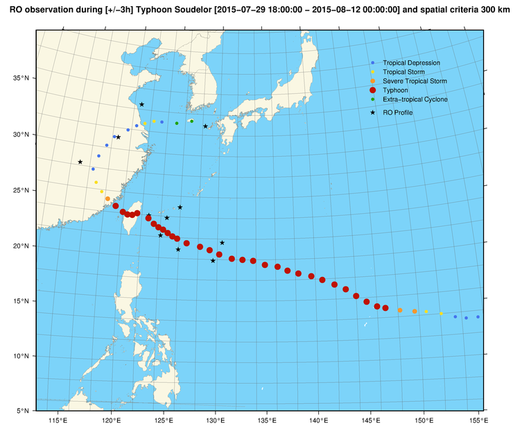
See more on geo2 visualization service
References:
Awange, J. L. (2012). Environmental monitoring using GNSS. Springer, Berlin, 382pp.
Huang, C. Y., & co-authors (2010). Impact of GPS radio occultation data assimilation on regional weather predictions. GPS Solutions, 14(1), 35-49.